NPS Website
 WHAT IS IT?
A National Park, suited especially for hikers, which includes the highest peak in Texas. During the Permian age, the area was underwater and the Guadalupe Mountains are actually the remnants of a non-coral reef.
BEAUTY (7/10)
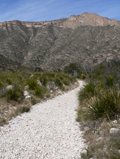
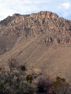
The exposed reef that is the Guadalupe Mountains certainly has an imposing quality. The bald rock face of the El Capitan peak and the soaring Guadalupe Peak rise vertically in a dramatic way. The hikes to the “Top of Texas” will take you from the high desert into the forest. The Park reminds the visitor that the show comes in fall, when the autumn colors light up the maple, walnut, ash and sumac trees of the McKittrick Canyon.
HISTORICAL INTEREST (2/10)
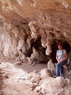
The ruins of a geologist’s cabin remain in McKittrick Canyon. Mescalero Apaches hunted and probably lived in the area. Not much here captures the historical imagination.
CROWDS (8/10)
Hiking is your only option at the Park. As a result, a more determined and outdoorsy set travels here. Everyone is very friendly and sharing the same experience.
We really enjoyed the terrific $8 per night campground despite the sub-40º evening temperatures. Not only were the sites charming and spacious but they were designated tent only. No RV’s, pop-up car tents or even vans were allowed in; they were segregated into their own campground, which amounted to a nearby parking lot.
EASE OF USE/ACCESS (1/5)
The Guadalupe Mountains NP is located 99 miles east of El Paso, Texas along U.S. Route 62/180. There are no driving tours through the National Park. The only way to experience the Park is by hiking into it.
CONCESSIONS/BOOKSTORE (3/5)
A decent set of Texas geology, nature books and titles about the nearby National Park Sites. You can purchase wooden hiking sticks here too.
 COSTS (3/5)
Entrance is $3 per person or free with the National Parks Pass.
RANGER/GUIDE TO TOURIST RATIO (2/5)
There were a few very helpful volunteers at both the Visitor Center and the McKittrick Canyon trailhead. On our return back along the McKittrick Canon trail, we ran into a Ranger and a volunteer. They both answered our many reef-related questions. We still cannot get our heads around the notion that we are looking at the remnants of a non-coral reef. In fact, we still are not sure what a non-coral reef is. Geology is difficult for us.
TOURS/CLASSES (4/10)
The Visitor Center Museum utilizes a touch screen computer that is supposed to make up for the lack of Ranger help. It doesn’t. Geology is not something we can comprehend with graphs, charts, confusing words and text explanations. Our knowledge of the Capitan Reef and the formation of the Guadalupe Mountains is entirely superficial.
The non-geology part of the Museum is the old fun standby: stuffed fauna in a faux natural setting. The wild turkey, coyote, golden eagle and many others are representative of the local wildlife. There are touch-me tables, comfortable couches and even an insect collection. We actually enjoyed our time at the Museum.
FUN (8/10)
Though not as dramatic or grand (or warm) as Big Bend NP, its larger NPS neighbor to the south, Guadalupe Mountains NP invited us in and charmed us, made us feel welcome, like the park was just for us. After days of trying to squeeze between mammoth RVs, like we were the ones inconveniencing everyone by taking up a whole campsite with our puny tent, we took devilish delight at seeing the machines relegated to the parking lot.
We arrived at the Park around lunchtime, walked into the Visitors Center and were immediately presented with a set of hiking options. “If you’re feeling up to it, now would be a great time to see McKittrick Canyon. Gates close at 4, though.”
The trailhead for the Canyon lies 7 miles north of the VC on US62 and 4 miles further down a park road. We set our watches to make sure we were back to the Altima before the gates were locked and off we went.
 The scenery was green, the hike uneventful other than the large mule deer we scared near the Hunter Line Shack. We spent most of the walk trying to understand the geography of the Guadalupe Mountains and plotting what we would have for dinner back at our beautiful campsite. It was a wonderfully pleasant afternoon.
WOULD WE RECOMMEND? (6/10)
With rain in the forecast for the next few days, we didn’t feel too bad skipping Guadalupe Peak, opting instead for the dryer innards of Carlsbad Caverns NP. But if you are looking for a great place to pitch your tent or have any desire to make it to the “Top of Texas,” Guadalupe Mountains NP is the place to be.
TOTAL 45/80
www.usa-c2c.com
© 2004-06